Data Visualisation & Software
Data access, visualisation & animation tools to support new applications, training, public engagement & citizen science
Data Visualisation & Software
Data Visualisation & Software
Data access, visualisation & animation tools to support new applications, training, public engagement & citizen science
CROWD4SAT
Citizen science & data analysis tools
for Earth observation & astronomical data
Data software, visualisation & access tools
Imperative Space has capabilities in the development of apps and software architectures to enable improved data access and tools for ‘non-technical’ users. We also have expertise in 3D and advanced data visualisation and have collaborated in other ground-breaking data visualisation ventures such as Carbon Visuals and EarthX.
This area of our work has included the ESA Crowd4Sat citizen science initiative working with Earth observation and astronomical data from satellite platforms, and the associated Planetary Response Network platform for humanitarian use cases. We also developed the Copernicus Online Image Archive service for EUMETSAT to support rapid creation of Earth observation animations using data from the Sentinel satellites and Copernicus services.
We also continue to conduct R&D in various aspects of advanced data visualisation, including emerging projects in VR.
Some examples of our past work are described below. For more information about our data visualisation and app development capabilities, please contact us.
Data software, visualisation and access tools
Imperative Space has capabilities in the development of apps and software architectures to enable improved data access and tools for ‘non-technical’ users. We also have expertise in 3D and advanced data visualisation and have collaborated in other ground-breaking data visualisation ventures such as Carbon Visuals and EarthX.
This area of our work has included the ESA Crowd4Sat citizen science initiative working with Earth observation and astronomical data from satellite platforms, and the associated Planetary Response Network platform for humanitarian use cases. We also developed the Copernicus Online Image Archive service for EUMETSAT to support rapid creation of Earth observation animations using data from the Sentinel satellites and Copernicus services.
We also continue to conduct R&D in various aspects of advanced data visualisation, including emerging projects in VR.
Some examples of our past work are described below. For more information about our data visualisation and app development capabilities, please contact us.
CROWD4SAT
Citizen science & data analysis tools
for Earth observation & astronomical data

Copernicus Online Image Archive
Software architecture & portal development to support rapid animation creation
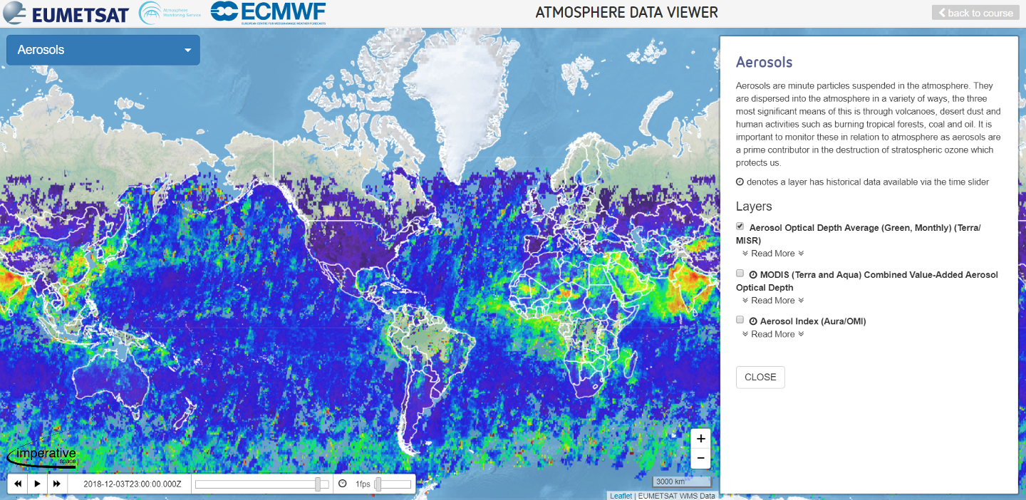
Educational Data Viewers
Adaptable educational EO data viewer for integration with online courses
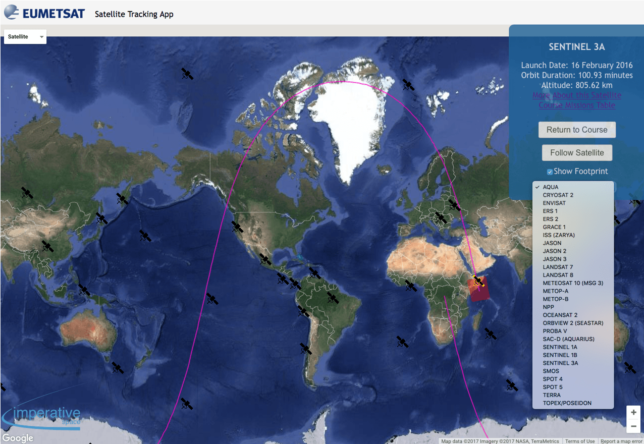
Configurable Satellite Tracking App
Tool for real-time tracking & information about multiple satellites based on thematic areas
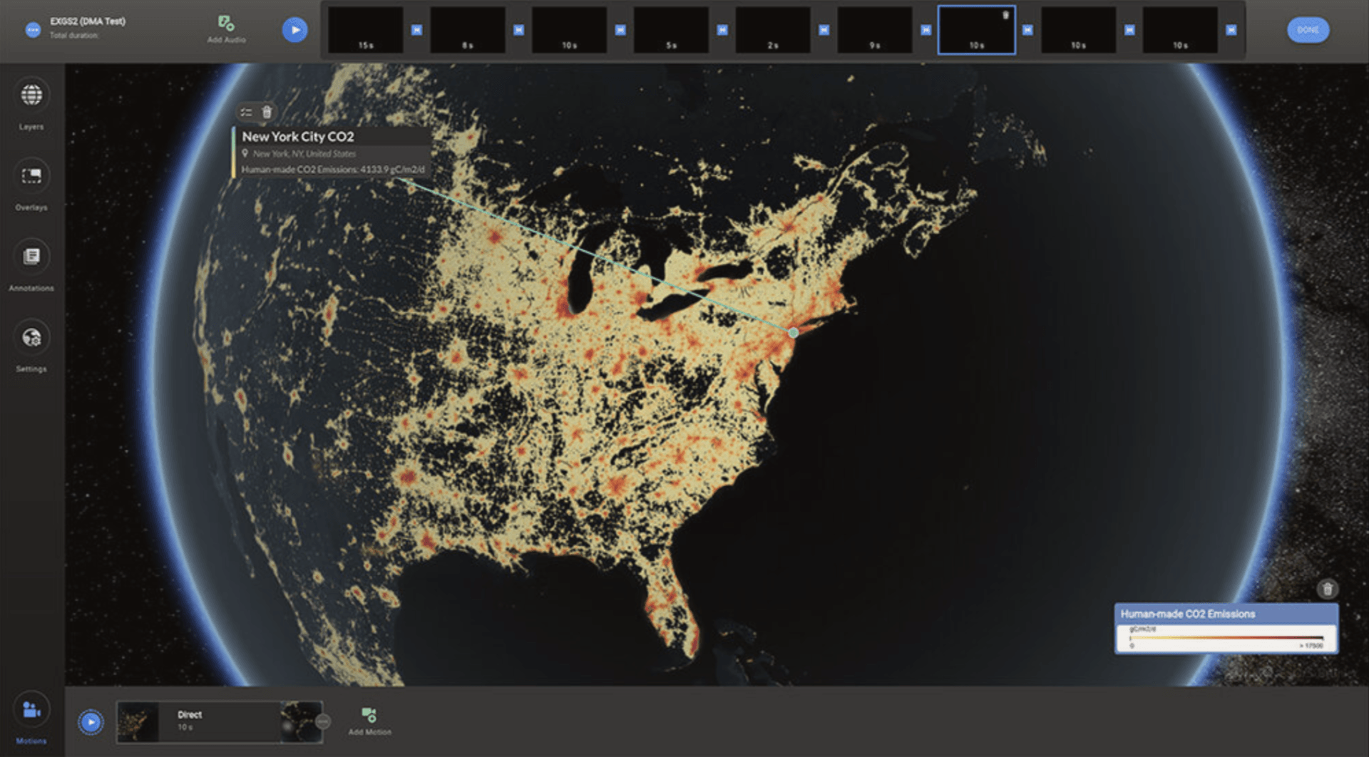
EarthX
Consultancy, UX design & creative support for development of the EarthX platform
Copernicus Online Image Archive
Software architecture & portal development to support rapid animation creation
Educational Data Viewers
Adaptable educational EO data viewer for integration with online courses
Configurable Satellite Tracking App
Tool for real-time tracking & information about multiple satellites based on thematic areas
EarthX
Consultancy, UX design & creative support for development of the EarthX platform
Copernicus Online Image Archive
Software architecture & portal development to support rapid animation creation
Educational Data Viewers
Adaptable educational EO data viewer for integration with online courses
Configurable Satellite Tracking App
Real-time tracking & information for multiple satellites & thematic areas
EarthX
Consultancy, UX design & creative support for development of the EarthX platform